
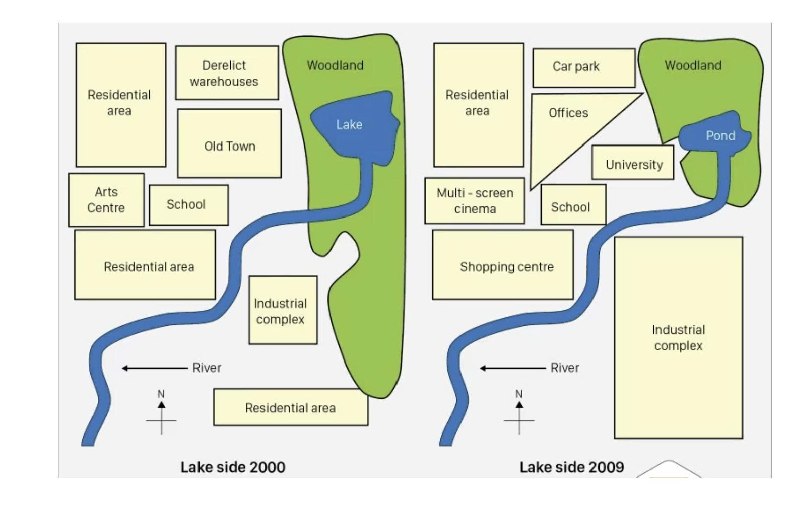
The given maps illustrate how Lake side changed over nine years, from the start of twenty first century to 2009. Overall, it is clear that the north side of the lake had undergone significant transformations, with the most noticeable change was the reduction of the woodland From the northeast of the lake, the residental area and the lower half of the woodland have been both demolished, which than replaced by the massive industrial complex. Moreover, the arts center buliding has been renovated into a multi-screen, whereas the north residental has been repurposed as a shopping center. The left corner residental area was the only building that remain unchanged. Meanwhile, the large lake was minimized in size that now considered a pond. Furthermore, the derelict warehouses have been replaced by the car parks. The old town was then torn down, where the offices and university then have been built. Finally, the school relocated slightly to northeast while also compacting the building into a smaller facility.
รายละเอียดตัวอย่าง
The two maps show the changed of lake side from 2000 to 2009
20/07/2026 12:57 5.5 คะแนน
หัวข้อ
The two maps show the changed of lake side from 2000 to 2009
จำนวนคำ: 164
แผนภูมิ/กราฟ
Essay
คะแนนรวม
5.5±0.5
พื้นฐาน
คะแนนเกณฑ์การเขียน
TA5.0
CC6.0
LR6.0
GRA6.0
คลิกข้อความที่ไฮไลต์ในเรียงความเพื่อดูคำแนะนำรายละเอียดเพื่อพัฒนา
การวิเคราะห์เชิงลึก
Task 1 - Academic Writing
4 tools available
บทความตัวอย่าง - IELTS Writing Task 1
ยังไม่มีบทความตัวอย่าง
กดปุ่มด้านล่างเพื่อวิเคราะห์และสร้างบทความตัวอย่างคุณภาพสูงสำหรับ Task 1